
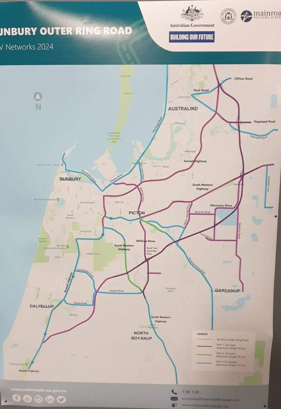
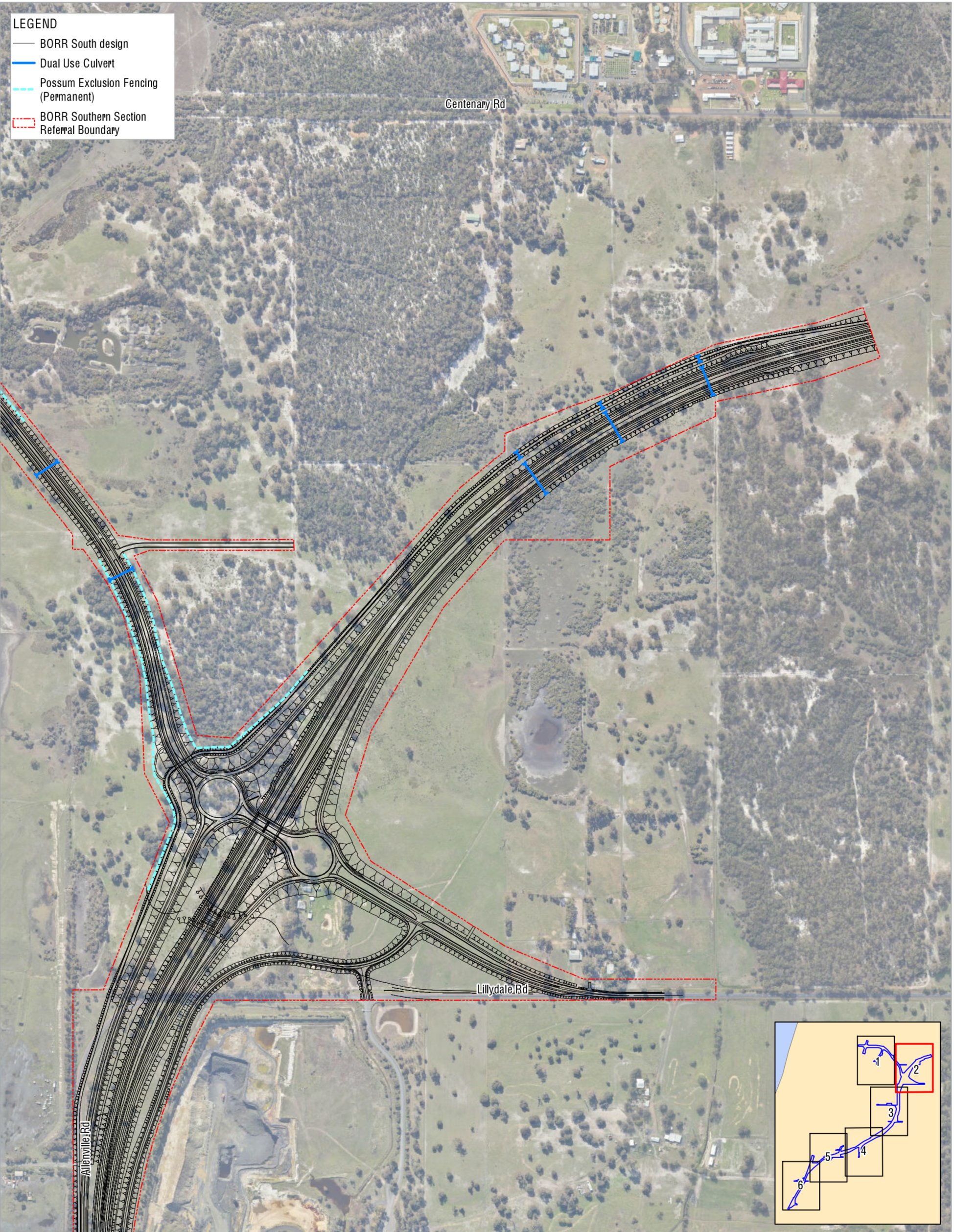
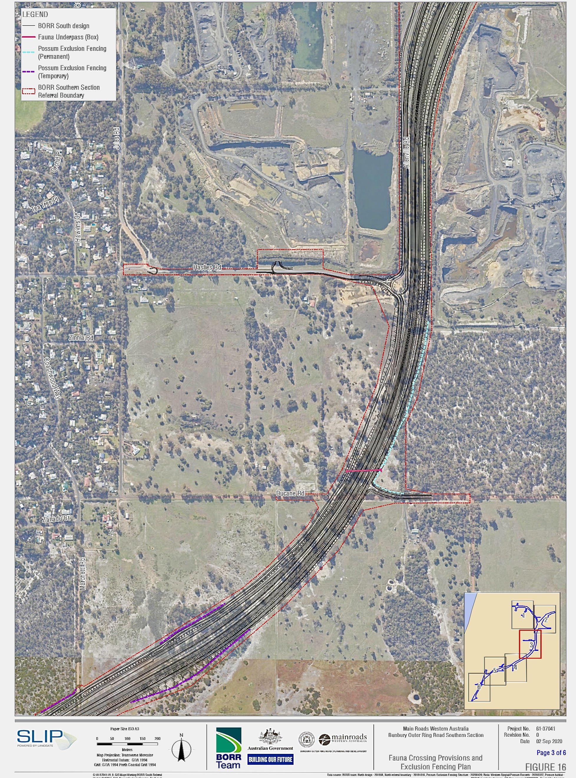
Maps of the Region
View plans and maps of the Bunbury Outer Ring Road Southern Section (BORR). Updated and new plans appear regularly from Main Roads WA. From a two lane road to a extensive freeway system. Constantly changing designs that confusion and cause anxiety amongst the residents of the area (including Gelorup, Dalyellup, Stratham and Capel)

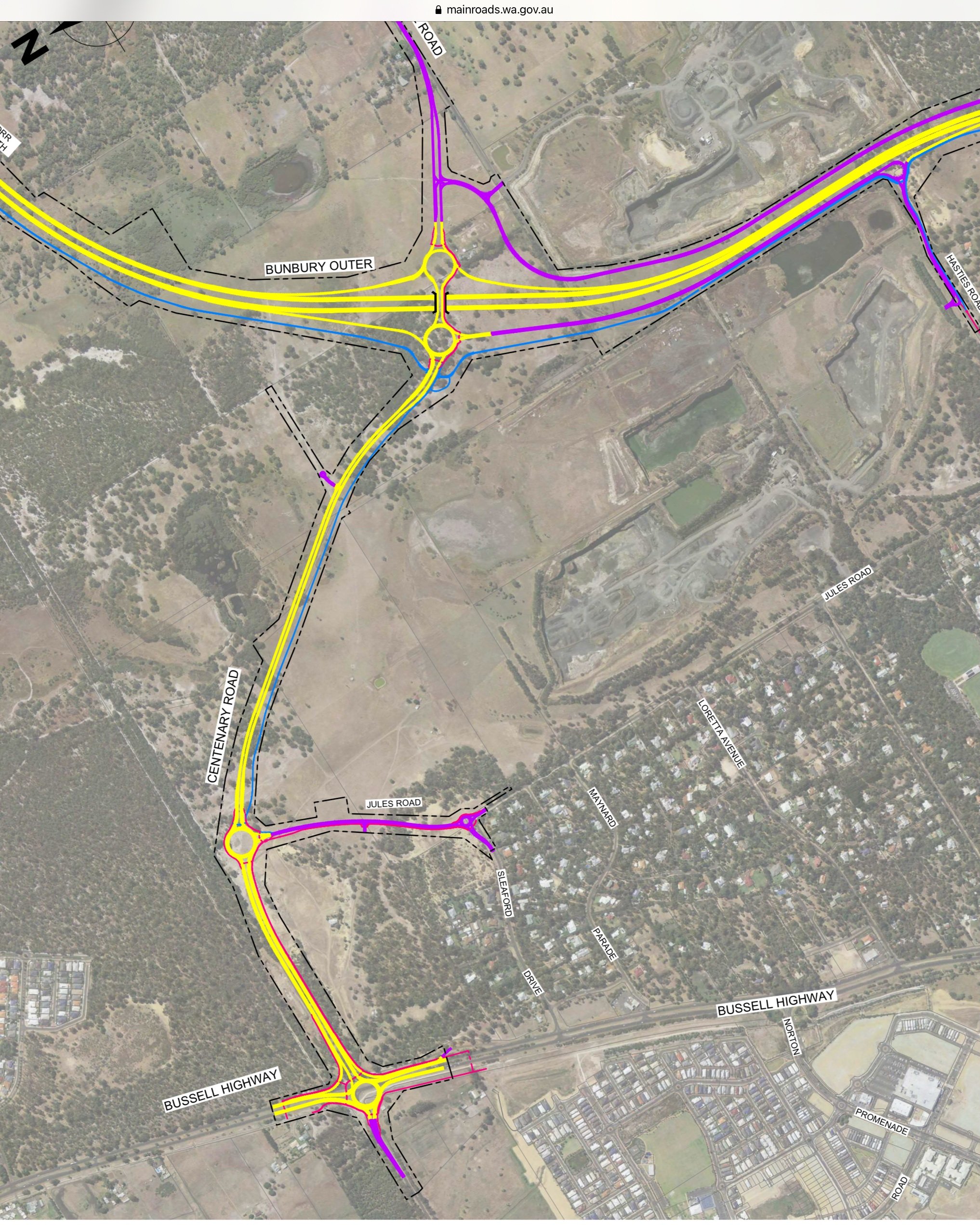


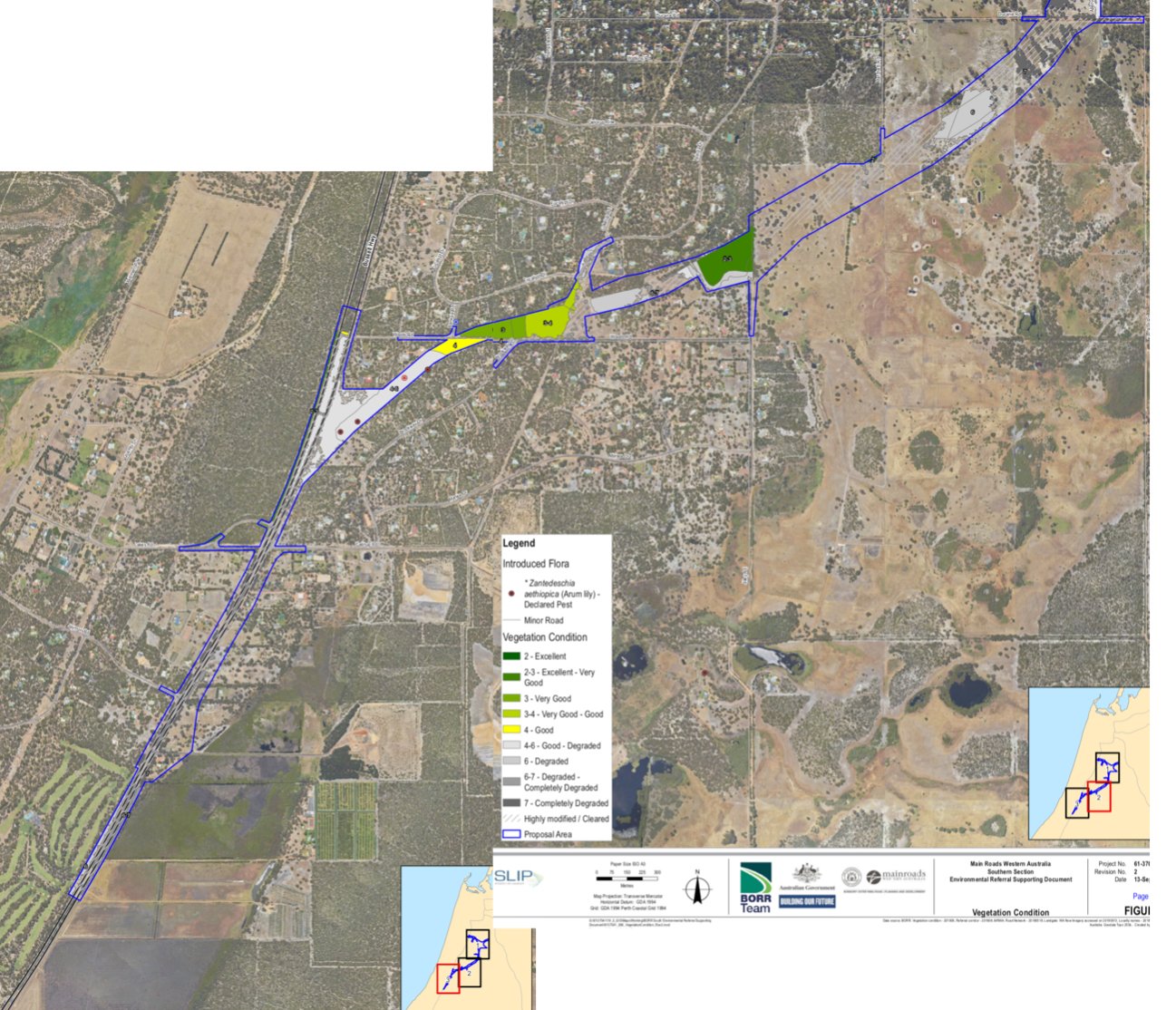
New North Gelorup Map


A) Original BORR map from the 70’s. This map shows the proposed regional bypass.
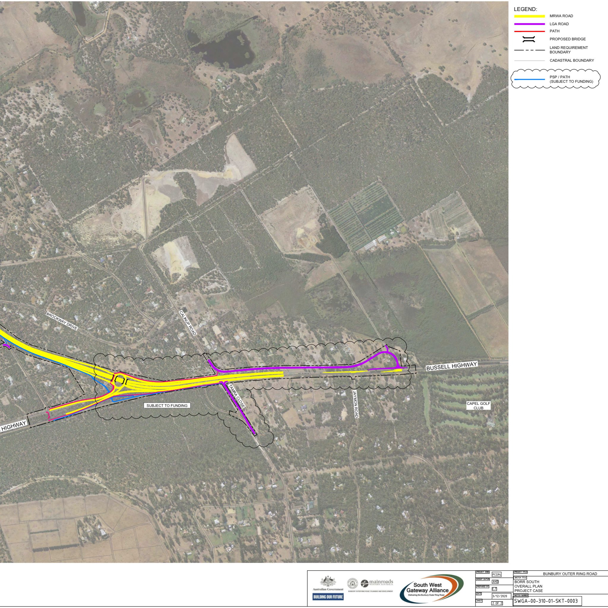
B) BORR Team map from October 2019. This map was presented to the Gelorup community following specific requests from community members at the Community Reference Group meeting in October 2019.
C) Town Planning Map from 1975 showing land uses. Pre special rural subdivisions.
E) The Ultimate Planning Concept from Main Roads WA, February 2020.
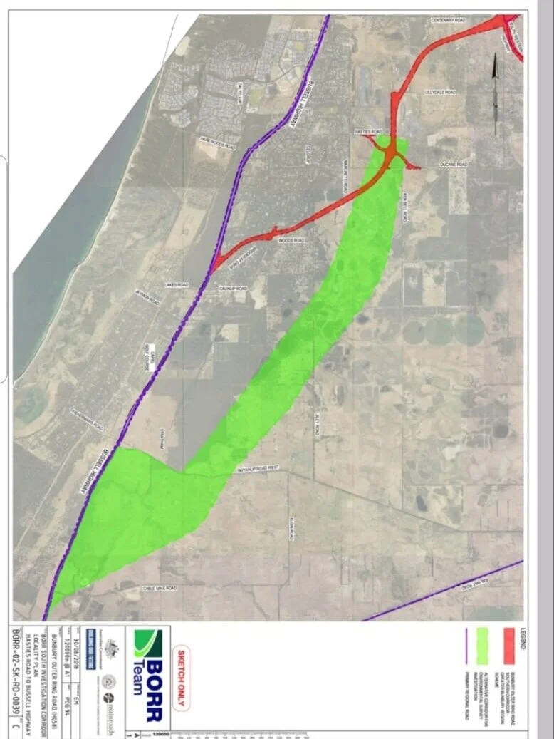
D) BORR Team map from July 2019. Map showing the alternative Green Corridor which is several routes explored as an alternative to the Red Route.

F) This map shows all the properties south of Hasties rd that will be potentially affected by the BORR. The black dash lines showing land resumptions that the council is assuming will need to take place due to the BORR and possible upgrades of Bussell Hwy and this does not even include the roads now affected by the new Centenary Rd Jules Rd connections.
Green and red surveyed routes